When a crew isolates a broken main, an assessor records a new subdivision, or a planner reviews a development application, GIS is part of the operating environment. In many agencies, one platform supports public works, water, stormwater, land records, planning, and emergency response across departments that budget and report separately.
That makes modernization more than a software upgrade. Esri describes GIS as shaping state and local government processes, workflows, policies, and engagement with citizens. When one platform carries that much public service, the question is not where GIS should run but whether every department can trust the data, depend on the workflows, and operate the platform at the level residents expect.
It is written for CIOs, IT directors, GIS managers, department leadership, and evaluation committees responsible for GIS in state agencies, counties, cities, special districts, and public authorities. It covers what GIS for government should do, where environments break down, how it supports daily operations, which decisions matter most, and how to approach procurement.
1. What Your GIS Should Be Doing
A modern government GIS provides an authoritative spatial foundation every department can use. Pipes, valves, roads, parcels, easements, zoning districts, and addresses are spatially related. The value of GIS in government is not the number of maps produced; it is whether those relationships are accurate, governed, and available to those making decisions.
For utilities and public works, engineering and customer service teams work from current records instead of parallel spreadsheets, and field crews return observations to a governed record. For planners and land records staff, parcels, zoning, land use plans, and infrastructure capacity can be evaluated together during development review.
For leaders, GIS should support public accountability: where maintenance demand is concentrated, where capital priorities and comprehensive plan goals intersect, and which residents an outage may affect. Citizen-facing maps and open data extend that value, but no public application compensates for records that staff do not trust.
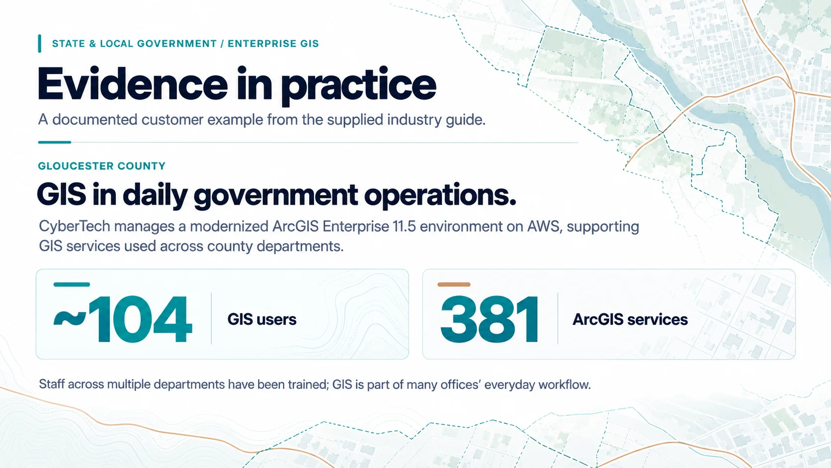
Evidence in practice: Gloucester County runs a modernized ArcGIS Enterprise 11.5 environment on AWS through CyberTech’s managed services, serving approximately 104 GIS users across 381 ArcGIS services. A senior planner in the County’s public works department reports that multiple departments have been trained and that GIS is part of many offices’ everyday workflow, which is how cross-department value shows up in practice.
2. Where Government GIS Environments Break Down
Government GIS environments rarely become difficult to manage because of a single failure. Departments add applications, publish one-off services, and build integrations until the platform carries more of the agency’s operations than its architecture, staffing, or governance were designed to support.
CyberTech’s state and local government work points to a recurring pattern: parcel, infrastructure, and location datasets are maintained separately by public works, planning, tax assessment, and emergency management, and competing versions erode confidence. Other symptoms are familiar in municipalities and state agencies alike: paper-based field updates, manual backups, deferred upgrades, and dependencies that surface during change.
The City of Portsmouth shows how these conditions converge. CyberTech’s case describes an aging ArcGIS Enterprise 10.9.1 environment with manual backups, limited infrastructure visibility, and no process for validating changes before production, supporting the City’s water, sewer, and stormwater networks and field crews.
Government constraints shape the response. Agencies work within open records rules, procurement cycles, and fixed budget calendars, and modernize while existing systems stay in service. A current-state assessment should therefore cover infrastructure, data, applications, integrations, governance, security, and departmental requirements.
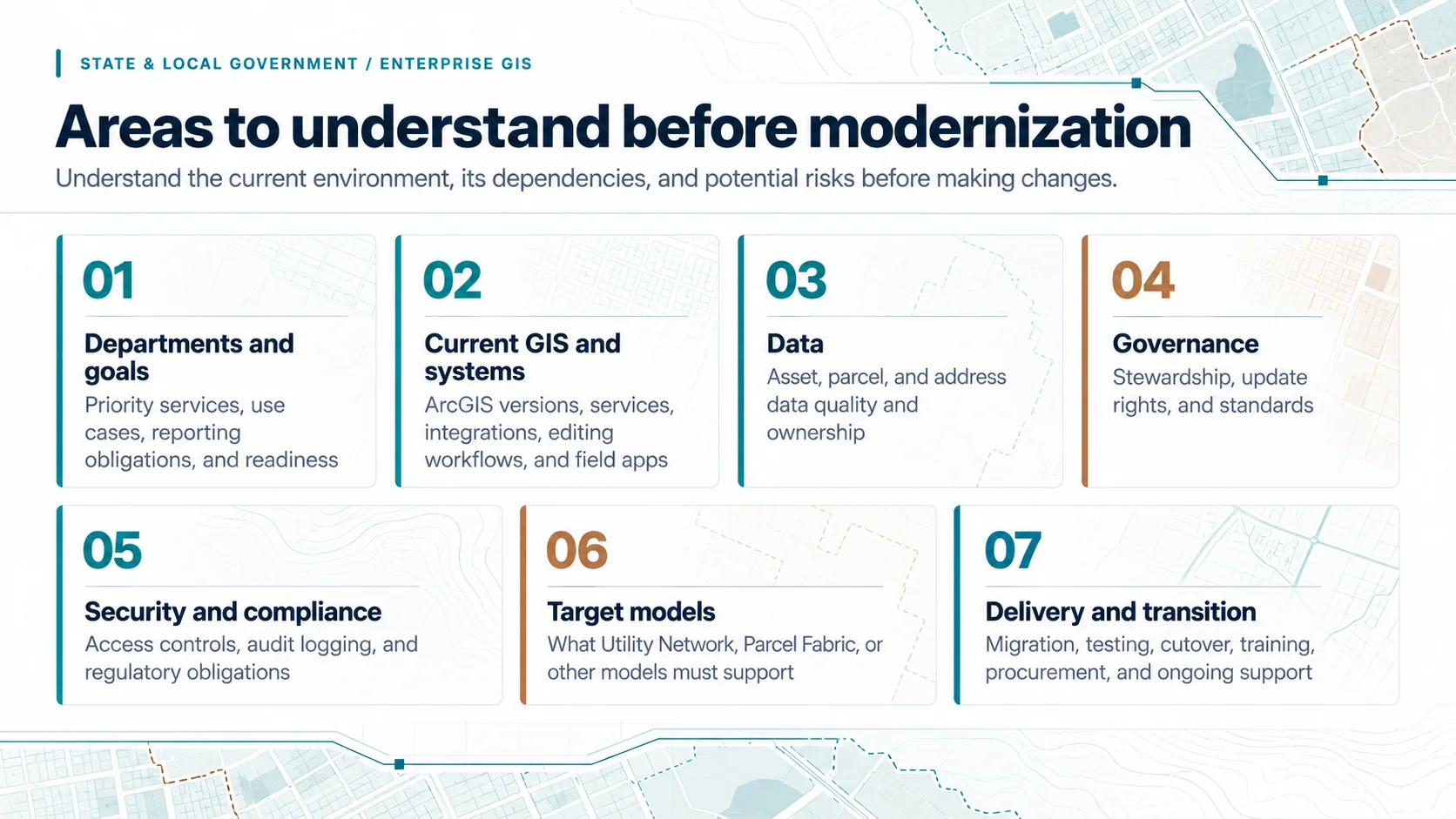
Areas to understand before modernization
A current-state assessment should show what the environment supports today and what could create risk during change.
3. GIS in Daily Operations
Public works GIS, and government GIS more broadly, is tested in routine operations and during change. In a main break or storm event, teams must locate assets, understand connectivity, identify isolation points, notify residents, and coordinate with the emergency operations center. Planned maintenance needs asset history, inspection records, and a path back to the enterprise record. Resilience planning shows where condition, growth, and investment priorities intersect.
GIS in urban planning and land records depends on the same foundation. Esri describes planners using ArcGIS to streamline project reviews, engage stakeholders, and model zoning and land use scenarios. That geospatial analysis in urban planning is only as reliable as the parcel, right-of-way, and utility capacity data beneath it.
State agencies face the same requirement at a different scale. Esri’s case of the Rhode Island Department of Transportation describes paper-based capital planning without common naming conventions or data models before the agency rebuilt project intake around GIS. Standardizing assets and project boundaries gave staff an authoritative source and residents a public dashboard.
Esri’s architecture, engineering, and construction resources describe GIS and building information modeling (BIM) as a shared environment across the project life cycle. Capital project data should reach the operational record at handover, not arrive later as drawings to redigitize.
The practical question is whether the end-to-end workflow holds. Can a crew find the right asset? Can a field update reach the right record? Can permitting and customer service systems use it, and can departments keep operating during change?
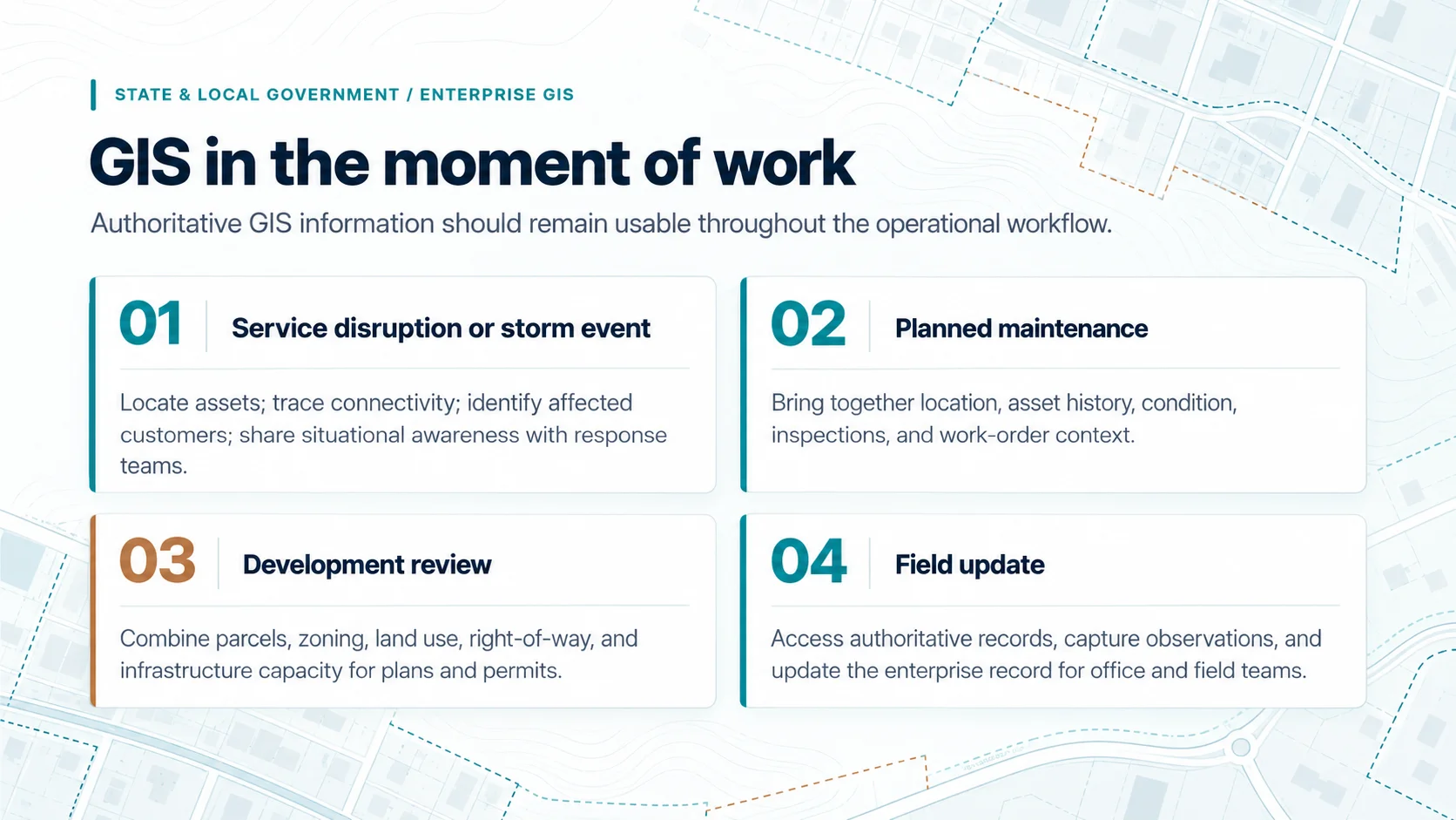
GIS in the moment of work
The value of GIS is visible when authoritative information stays usable across departments and workflows.
4. The Decisions You’ll Face
Five decisions deserve particular attention because they shape risk, scope, and long-term support.
4.1 Where should the platform run?
Start with requirements, not a preference for cloud or on-premises infrastructure. Esri’s ArcGIS Well-Architected Framework ties reliability to the service level an organization’s workflows require, measured through tailored service level agreements rather than generic uptime targets. Procurement constraints, staff capability, and hybrid options belong in that assessment.
A public map supporting a zoning initiative can see short demand spikes, while a parcel or utility editing environment may need stricter recovery objectives. Esri reports FedRAMP Moderate authorization for ArcGIS Online and Esri Managed Cloud Services in U.S. operations, and obligations vary by program. Cloud supports these objectives but is not, by itself, modernization.
Workload separation is one response. NJ TRANSIT, among the largest public transit operators in the United States, runs managed ArcGIS Enterprise on AWS for more than 600 portal members, with a federated ArcGIS Image Server so imagery workloads do not compete with other operations.
CyberTech’s case of Middlesex County, New Jersey shows a cloud move structured around continuity: ArcGIS Enterprise on Microsoft Azure under Managed ArcGIS Cloud Services, with dedicated development, staging, and production environments, high availability, and an automated transition from ArcMap to ArcGIS Pro.
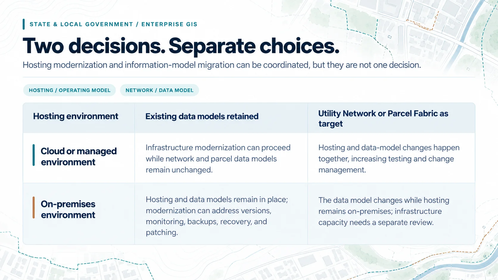
Two decisions that should not automatically become one
The choice of where the platform runs and the timing of information-model changes can be coordinated, but they need not move together.
| Deployment | Existing data models retained | Utility Network or Parcel Fabric as target |
|---|---|---|
| Cloud or managed environment | Infrastructure modernization can proceed while network and parcel models remain unchanged. | Changes to hosting and the data model occur together, increasing testing and change management. |
| On-premises environment | Hosting and data models remain in place; modernization can still address supported versions, monitoring, backups, recovery, and patching. | The data model changes while hosting stays on-premises; infrastructure capacity still needs separate review. |
4.2 What should be shared, and who governs it?
Government GIS often grows department by department, each with its own data and tools, so the shared-platform decision is as much about governance as technology. Decide which datasets are enterprise assets, such as parcels and core infrastructure, and which remain department-owned. For each enterprise dataset, name a steward, define who may edit it, and set the standards others follow.
Consider an approved subdivision: planning approves it, the assessor records the parcels, public works extends the mains, and emergency management needs the addresses. Governance decides which edit is authoritative and how each department receives it without keeping a competing copy.
Esri’s Well-Architected Framework addresses this with guidance on data governance, staff roles, collaboration, and change management. CyberTech similarly notes that an enterprise GIS establishes one authoritative source across departments, with role-based access controls and audit logging.
Middlesex County shows the scale this reaches. CyberTech reports that the county oversees operations across 25 municipalities with disparate systems and uneven technical capacity and has extended shared platforms and licensing to smaller municipalities to support regional data sharing and shared application development. Departments and jurisdictions can join in phases while existing systems stay in service.
4.3 Utility Network and Parcel Fabric: whether, when, and how far
ArcGIS Utility Network changes how utility assets and their connectivity are modeled, so adoption is a network-management and workflow decision, not a data conversion. Readiness depends on connectivity quality, attribute completeness, validation requirements, dependent integrations, and cutover testing.
Land records follow similar logic. Esri explains that ArcGIS Parcel Fabric creates and edits parcels in response to changes in the legal record, such as plats and deeds, and tracks parcel history. For a county assessor, adopting that model means resolving legacy topology issues, documenting editing procedures, and training editors before production use.
Neither model is mandatory, and many agencies operate well without either. Where one applies, it need not coincide with hosting. Portsmouth’s cloud environment includes federated Utility Network servers for its water and sewer-drain workloads, showing a platform can be designed for current and future information models together.
Central Arkansas Water, a regional public water utility serving nearly 500,000 people across eight counties, shows the sequence. CyberTech’s engagement began by assessing architecture, accumulated data, and operational dependencies, and Utility Network work followed platform modernization rather than coinciding with it. Sequencing should follow data readiness, staff capacity, and tolerance for concurrent change.
4.4 Who should run the platform?
The operating model should assign responsibility at each layer. Who owns the cloud account or data center? Who administers, monitors, patches, and upgrades ArcGIS Enterprise? Who manages backups, tests recovery, handles incidents, and approves production changes? CyberTech’s public-sector guidance emphasizes setting recovery time and recovery point objectives, then validating them through restore testing.
CyberTech’s cases show the split can vary. In Portsmouth, the City retained its AWS infrastructure while CyberTech operated the ArcGIS environment through MACS Advanced. The case reports a phased development-to-production migration, an upgrade from 10.9.1 to 11.5 with zero rollback, automated daily backups, retention extended from 7 to 90 days, approximately 50 GIS users and 640 services, and 99.88 percent availability since go-live.
In Gloucester County, CyberTech manages both the AWS infrastructure and the ArcGIS environment, including patching, incident management, and quarterly restoration checks. Updates that once caused downtime now run after hours. Neither model is universally better; ownership must be explicit in the service level agreement.
4.5 What connects to what?
Enterprise integration is an ownership decision. GIS may be authoritative for asset location and connectivity, an asset management system for maintenance history, a customer information system for billing, ePermitting for approvals, 311 for service requests, and computer-aided dispatch (CAD) for incidents. Each boundary is where records can drift.
For each integration, define which system owns each record, the direction updates move, how conflicts and failed transactions are handled, which security controls apply, and who resolves exceptions. Without those decisions, integration can automate inconsistency as easily as it automates work.
Publishing to residents is also an integration: open data portals and public dashboards should draw from governed services, with access controls separating public layers from sensitive infrastructure detail. Esri lists CyberTech’s Unity Engine as a solution bridging GIS and enterprise asset management systems.
5. Procurement and Choosing a Partner
Procurement shapes the engagement before architecture does. Confirm contract vehicles and purchasing routes with the procurement office before scope is set, and establish how security review, data ownership, and transition obligations enter the contract rather than being settled after award. CyberTech notes that Esri reviews a partner’s track record before awarding its State and Local Government Specialty, providing evaluation committees with independent verification.
Evaluate partners against the environment the agency must support. Credentials establish capability; they do not replace evidence of delivery. Esri’s Partner Network profile lists CyberTech as a Platinum Partner with specialties in ArcGIS Cloud Services, State and Local Government, Network Management, and Imagery.
Ask for evidence from comparable agencies. Can the partner explain current-state dependencies before proposing an architecture? Can it show how validation, integrations, testing, cutover, and training will be handled for each department? Can it define what the agency owns after go-live, how recovery, escalation, and production changes are governed, and how state-specific compliance obligations are confirmed?
The sequence depends on procurement, budgets, data readiness, and staff capacity. What matters is resolving the decisions that determine whether modernization can move safely into production.
What should be resolved over the next 12 months?
- Establish the current-state baseline. Document the environment, data quality, integrations, critical workflows, security requirements, and recovery expectations.
- Set authoritative ownership. Define which department and system owns each critical dataset, how updates move, and how exceptions are resolved.
- Choose the target architecture. Decide where the platform runs and which reliability, recovery, and change-management practices each workload needs.
- Make the information-model decisions. Confirm whether Utility Network or Parcel Fabric is in scope now, later, or not at all, based on data readiness and capacity.
- Define the operating model. Clarify responsibilities across GIS, IT, security, cloud infrastructure, and providers, including escalation and knowledge transfer.
- Agree on outcomes. Choose measures such as availability, recovery test results, field adoption, data-quality exceptions, or review cycle times.
Conclusion
For state and local government, GIS modernization is about operational confidence across departments. The platform must maintain trusted infrastructure and land information, support field and office workflows, and meet the reliability and security expectations of the services built on it.
The right starting point is not a migration date or a preferred deployment model. It is a clear view of the current environment, the services that must remain available, and the data each department must trust. From there, cloud, Utility Network, Parcel Fabric, integration, and managed services become connected decisions, not isolated projects.