Contents
Client Overview
Middlesex County, New Jersey, in partnership with Esri and CyberTech, is leading a groundbreaking effort to modernize government services through advanced Geographic Information Systems (GIS) and cloud-based solutions. This case study explores the county’s strategy, implementation, and outcomes, highlighting lessons learned and a vision for scalable, data-driven governance. Under the leadership of County Administrator John Pulomena, the county adopted Esri’s GIS platform, in partnership with CyberTech, to drive region-wide digital transformation.
Business Challenges
Middlesex County oversees operations across 25 municipalities, each with unique needs, legacy systems, and varying capacities for technology adoption. Key challenges included:
- Cultural Resistance to Change – Staff were initially hesitant to adopt new technologies.
- Siloed Systems Across Municipalities – Disparate systems and resource constraints limited data sharing and collaborative planning.
- Asset Management Complexity – The need to manage infrastructure such as roads, bridges, and water systems in a sustainable, lifecycle-based way.
- Compliance and Public Safety Needs – Adhering to environmental regulations (e.g., MS4) and enhancing public safety with integrated systems.
Solution
Technology Adoption
The county implemented Esri’s ArcGIS platform across multiple departments, transforming how assets, infrastructure, and services are managed and visualized.
Key applications include –
- Integrated Enterprise GIS – Built a centralized platform linking departments and municipalities.
- Mapped Core Assets – Roads, parks, recycling facilities, stormwater systems, and open spaces.
- Created Lifecycle Management Tools – For infrastructure investment planning.
- Launching a Network Operations Center – CA real-time hub for emergency response, infrastructure monitoring, and intelligent transportation systems using public safety tools.
- Enabled Regionalization – Extended shared platforms and licensing to smaller municipalities, increasing access and reducing costs.
Regional Collaboration
Recognizing that many municipalities lack technical resources, Middlesex County extended GIS platforms to local governments, facilitating:
- Regional data sharing
- License consolidation
- Shared application development
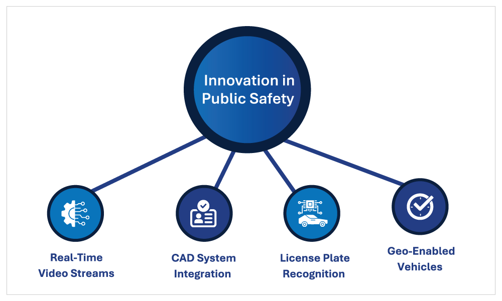
Innovation in Public Safety
A newly launched Network Operations Center integrates GIS with public safety tools. This
unified platform includes:
Partnership Model
Middlesex County’s GIS transformation was powered by a strategic partnership between the county government, Esri, and CyberTech that combined leadership, technology, and execution.
CyberTech implemented Managed ArcGIS Cloud Services (MACS) to securely host the GIS infrastructure in Microsoft Azure, creating dedicated development, staging and production environments for smooth operations. They modernized the system by migrating to Azure SQL Managed Instance for centralized data management and upgrading to ArcGIS Enterprise 10.9.1 with high-availability architecture. The partnership automated the transition from ArcMap to ArcGIS Pro and enabled virtualized workspaces for remote collaboration.
Results
Operational Efficiency
- Streamlined infrastructure planning.
- Enhanced decision-making through geospatial analytics by visual mapping helped unify departments and guide investments.
- Reduction in redundant systems and siloed data.
Improved Public Services
- Better user experience for residents through accessible GIS apps.
- Increased transparency and trust in local government initiatives.
- Tools like park locators and tax maps made data accessible to residents.
Regional Impact
- Scalable GIS model shared with 5–7 municipalities.
- Platform being explored as a statewide model for integration.
Compliance & Safety
- GIS-driven mapping improved stormwater infrastructure compliance and public safety oversight.
Collaborative Governance
- Strengthened inter-county relationships with neighbors like Somerset and Monmouth Counties.
Key Learnings
- Start Small, Scale Fast – Initial success came from focusing on 2–3 high-impact projects to gain buy-in.
- Public-Private Partnerships are Vital – CyberTech’s expertise filled internal capability gaps.
- GIS is a Change Agent – Beyond mapping, GIS fostered a data-driven culture, collapsing silos and enabling collaboration.
- Training is Critical – Ongoing investments in staff skills ensured long-term platform success.
Vision Ahead
Middlesex County is continuing to evolve its GIS strategy with a focus on:
- GeoAI and advanced analytics
- Mobility and real-time data integration
- Regional data standardization
- Workforce development
- Cross-county data integration
- Regional workforce development and training
- Public-facing tools that improve transparency and services
Conclusion
Middlesex County’s journey demonstrates the transformative power of GIS when combined with strong leadership, strategic partnerships, and a commitment to collaboration. With Esri technology and CyberTech’s guidance, the county is setting a new standard for smart, regional governance putting Middlesex “on the map” as a leader in public sector innovation.
CyberTech Systems and Software Inc.